Distinguished Land Design (DLD) approaches planning with a focus on vision, functionality, and foresight. The firm specializes in large-scale site and community planning, transforming ideas into clear, buildable concepts that balance creativity with practicality. DLD’s planning process involves analyzing site opportunities and constraints, determining the most effective placement of key elements such as schools, roadways, and open spaces, and providing clients with thoughtful, flexible options for development.
Planning extends beyond the preparation of CC&Rs, design guidelines, or specification documents — it represents the foundation of program development. Each plan is crafted to communicate ideas graphically, optimize land use, and anticipate future growth while maintaining cost efficiency and design integrity.
Planning-scale projects are often defined by program complexity, environmental constraints, and infrastructure coordination. One of the most critical challenges is achieving the required density and return on investment while maintaining livability and avoiding overcrowding—particularly on environmentally sensitive sites where developable land is limited.
Project Details
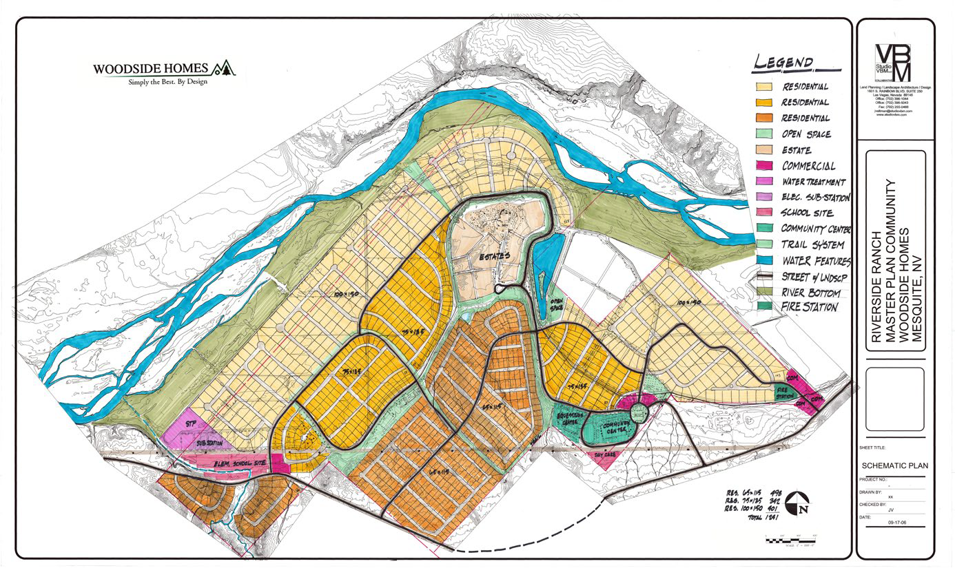
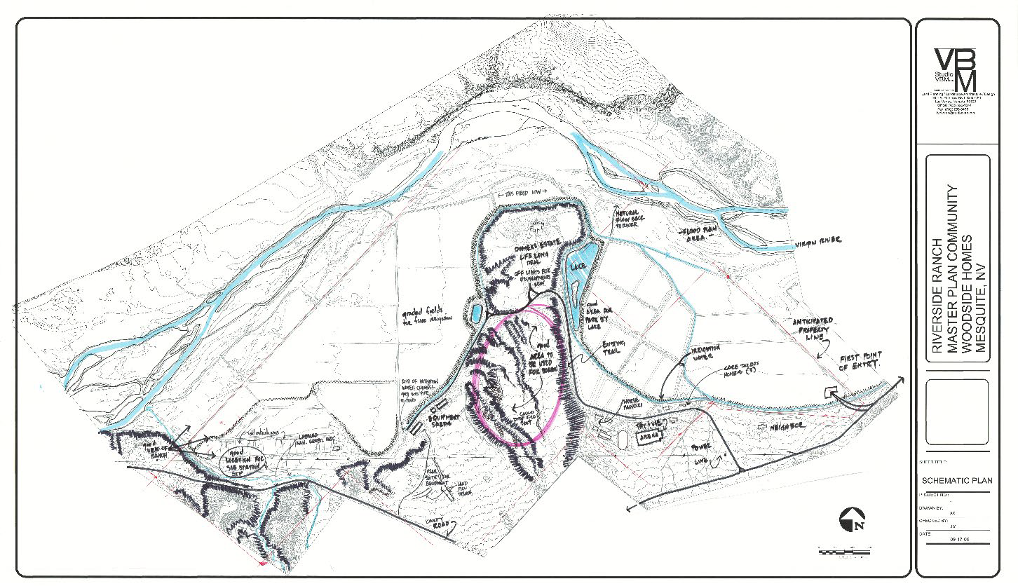
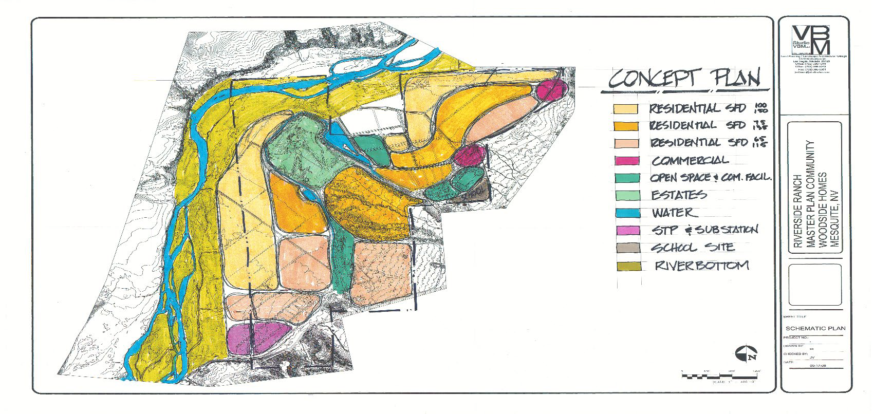
Riverside Ranch is a large-scale planning project for a new master planned community with an anticipated buildout of approximately 1,200 homes. The program includes a school, parks, commercial areas, a community center, and supporting infrastructure, including a power substation and water treatment facilities. The site also required careful consideration of river recreation, native flora and fauna, and long-term environmental stewardship.
The project demanded a planning framework capable of balancing diverse land uses, environmental sensitivity, and development feasibility while supporting a livable, cohesive community over time.
Balancing Density Through Lot Size Diversity
Rather than segregating residential areas by lot size or price point, we approached density by balancing and mixing lot sizes throughout the community. This strategy supported return on investment while avoiding the creation of economic zones, resulting in a more integrated and resilient neighborhood structure.
Responding to Environmental Sensitivity
The proximity of the river significantly influenced the planning approach. Buffers and conservation zones were established to protect ecological systems while defining clear limits for development. These areas also helped shape open space networks and recreational opportunities without compromising environmental performance.
Avoiding Overcrowding While Meeting Unit Goals
Density targets were evaluated carefully by reviewing and confirming the appropriate mix of unit and lot sizes. Rather than maximizing buildout, the plan prioritized a balanced distribution that maintained openness and long-term livability—recognizing that overbuilding can undermine both community quality and market appeal.
Aligning Amenities with Community Value
Schools, commercial areas, and community amenities were strategically located near smaller lot sizes and in desirable geographic areas, including river-adjacent zones. This approach helped distribute value across the site, supported walkability and access, and reinforced the idea that density and livability are not opposing goals.
Effective planning is not about maximizing units in isolation—it is about structuring growth so environmental responsibility, economic performance, and quality of life reinforce one another. This project illustrates how landscape architecture can guide that balance at the planning scale.